

Research opportunities
The Coasts and Estuaries Research Group has several research projects available for potential future students. These projects are available as Honours projects for those completing their undergraduate degrees and for postgraduate research programs (PhD and MPhil). Research projects currently underway within the group are detailed here.
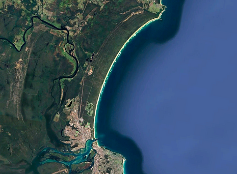
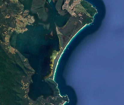
Resilience of coastal sand barriers: tipping points for overtopping and break-through
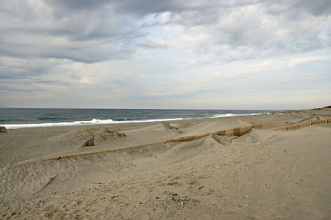
Investigate the conditions for overtopping, washover, rollover and break-through of estuarine and open-coast sand barriers, and their sensitivity/resilience to these processes for current and future ocean conditions (storm waves & water levels) and sea-level rise. The Deeban estuarine barrier-spit in Port Hacking experienced overwash, rollover and break-through in 2020 and will be a focus study site for data analysis and field work. Historical and recent morphological data will be analysed along with nearshore hydrodynamic datasets and ocean wave and tide data to understand what brought on the tipping-point change. Open-coast barriers to investigate could include Bribie Island (break-through event in 2022), and Manning Point, which may experience a very similar break-through to Bribie Island in coming years. The research will inform coastal planning/management by identifying the conditions and potential for tipping-point changes.
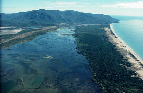
Shelf sediment transport pathways & timescales of central NSW coastal compartments

Investigate the sources, sinks and pathways for sediment transport and cross-shore connectivity between the coast and shelf, and alongshore connectivity between adjacent compartments of the mid-NSW region. High-resolution seabed mapping and sampling of Forster-Manning (completed), Coffs Harbour (in progress) and Port Stephens-Myall Lakes (future) compartments and bathymetric lidar data has revealed unknown complexity in sediment distributions and evidence for sediment transport and connectivity. Shelf morphology (including bedforms), sedimentology, and stratigraphy will be analysed to identify and investigate modern and relict sediment deposits and pathways, and the origins and dynamics of contemporary coastal sedimentary systems. There is potential to study headland sediment bypassing processes using hydrodynamic instruments to measure waves and currents around headlands. The research will inform the development of quantitative sediment budgets for future coastal and shoreline change modelling.
Extreme water levels in estuaries – driving processes and their timescales
This project will investigate extreme water levels in estuaries and assess the driving processes and their timescales. The project will use existing estuarine and ocean tide gauge data and complement that with additional estuarine hydrodynamic deployments. Data will be analysed to determine how each driving process (e.g., tides, sea level rise, atmospheric pressure, long period coastal trapped waves, and climate drivers) contributes to extreme water levels and their relative frequency, magnitude, and period distributions. These data will be used to assess future risks to estuaries from ongoing sea level rise and thus inform coastal management/planning processes.
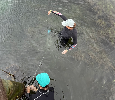
Wave overwash hazards and risk management on coastal rock platforms

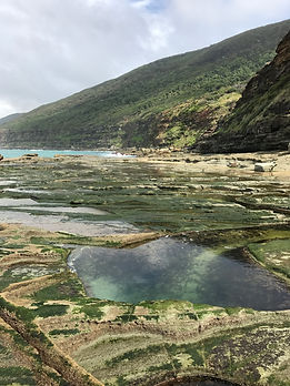
This project will investigate the conditions that drive ocean wave overwash on coastal rock platforms. The project will use an extensive remote sensing and hydrodynamics observation dataset collected at the famous Figure Eight Pools site in the Royal National Park south of Sydney to assess how water level, wave height, wave period, and offshore directional wave spectra influence the frequency and magnitude of wave overtopping that poses a hazard to visitors on the rock platform. Hydrodynamic data and remotely sensed data will be analysed to investigate the roles of offshore hydrodynamic conditions and platform morphology on wave overtopping. A predictive hazard warning system will be evaluated and further developed to apply to other coastal rock platforms in NSW. New field data will be collected at dangerous rock platforms in the Newcastle region to inform the modelling. This research will inform rocky shore coastal management and safety advisories for recreational visitors to rock platforms for activities such as tourism and rock fishing.
Morphological and hydrodynamic influences on extreme wave runup
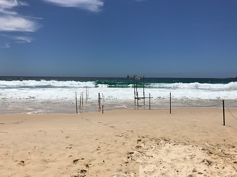
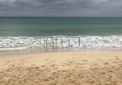
This project will investigate the morphological and hydrodynamic drives of extreme wave runup on sandy beaches. The project will use existing data collected by the CERG group over the past several years and supplement it with additional, targeted field experiments to further investigate the key drivers of extreme wave runup. Factors such as offshore wave spectra, surf zone hydrodynamics, surf and swash zone morphology, and wave-wave interactions will be assessed as to their relative influence on driving extreme wave runup and on the wave runup distribution. This research will inform coastal management by enhancing predictions of open coast wave runup, hence improving predictions of open coast inundation and dune erosion.
Glacial coastal evolution of Barwon Bank and controls on margin sediment distribution
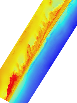
Investigate the origins and evolution of palaeo-coastline features and sediment deposits forming the Barwon Bank, including coastline migration and deposition during falling-stage, stillstand and rising (transgressive) sea level conditions. The project will investigate the morphology, sedimentology and stratigraphy of the region using data collected on the 2022 RV Investigator voyage, 2013 Southern Surveyor voyage, and adjacent surveys. A focus will be on reconstructing the coastline at different sea levels to investigate if this region was the terminus of the east coast alongshore sand transport system (and interface to the GBR carbonate province) at lower sea levels, as Breaksea Spit (K’gari) is at present highstand sea levels. This could extend to examining sediment cores from the adjacent continental slope. The research will contribute to understanding coastal landscapes, dynamics and deposition during the glacial periods that dominated the late Quaternary, and the distribution and availability of siliciclastic (quartz) sand along the southeast Australian coast and shelf.
Late-Quaternary coastal evolution and deposition on the central NSW shelf
Investigate coastal barrier migration and deposition across the central NSW continental shelf during late-Quaternary sea-level fluctuations, to determine the origins and character of drowned glacial-age coastal features and coastal dynamics and deposition during sea-level change. This project would use high-resolution seabed mapping and geological (seismic stratigraphy, sediment cores) datasets from the Newcastle and Foster regions to investigate and compare glacial coastal evolution between these settings, which share many similarities but also have some distinct differences. The research would use coastal barrier deposition/migration modelling to explore possibilities suggested by the datasets and reconstruct past coastal settings. The research would contribute to understanding glacial coastal environments and processes of which limited evidence remains at the seabed, with implications for understanding contemporary coastal dynamics and responses to sea-level change. It would also inform prospective offshore wind turbine projects on the Hunter shelf.
The evolution of the southeastern Australian continental margin
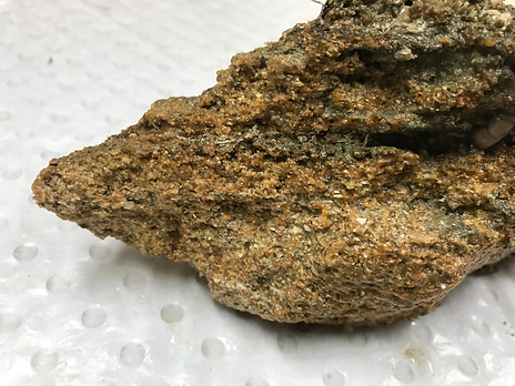
R/V Investigator voyage IN2022_V05 examined the submarine landslides and mass wasting processes along the southeastern Australian continental margin. This project will use the data collected during that voyage to better understand the evolution of the margin and the role of submarine landsliding in transferring sediments downslope. The project will also investigate how the margin has evolved and used both geophysical data and sediment samples collected during the voyage to obtain ages of key morphological features on the margin. The project has the potential to also use numerical modelling to assess the potential tsunami hazard from the submarine landslides. The research would inform our understanding of the evolution of the continental margin and the potential hazard from near-field tsunami.